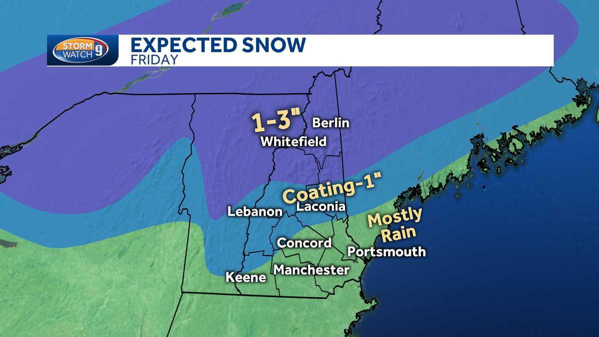
Understanding A Wintry Mix Of Rain And Snow

Table of Contents
The Science Behind a Wintry Mix
A wintry mix of rain and snow occurs due to a complex interplay of atmospheric conditions, primarily centered around temperature gradients within the atmosphere. The key factor is the variation in temperature at different altitudes. A crucial element in understanding a wintry mix is the concept of the atmospheric temperature profile – how temperature changes with height.
Imagine a situation where the ground temperature hovers around or just below freezing (0°C or 32°F). However, higher up in the atmosphere, warmer temperatures exist. Precipitation begins as snow high in the atmosphere where temperatures are below freezing. As this snow falls through the warmer air aloft, it may melt into rain. If it then falls through a layer of sub-freezing air near the ground, it can refreeze into freezing rain or sleet, depending on the duration and intensity of the sub-freezing layer.
- Temperature profile near the ground: Must be near or slightly below freezing for a wintry mix to form.
- Warmer air aloft: Allows for precipitation to initially form as snow or even rain higher in the atmosphere.
- Sub-freezing layer: As precipitation falls through this layer, it transitions to different forms like freezing rain or sleet.
- Ground temperature: Plays a vital role; if the ground is above freezing, freezing rain will melt into rain.
The altitude at which the temperature crosses the freezing point is paramount. A slight shift in this altitude can dramatically change whether you experience rain, freezing rain, sleet, or snow.
Types of Precipitation in a Wintry Mix
A wintry mix can encompass several types of precipitation, each with unique characteristics:
- Snow: Composed of ice crystals, snow falls when the temperature throughout the atmosphere is consistently below freezing.
- Sleet: These are frozen raindrops. They form when rain falls through a deep layer of sub-freezing air, freezing completely before reaching the ground. Sleet bounces on impact.
- Freezing rain: This is supercooled water—water that remains liquid even below 0°C (32°F). It freezes instantly on contact with surfaces like roads, trees, and power lines, creating a glaze of ice.
- Rain: Liquid water that falls when the temperature throughout the atmosphere remains above freezing.
Understanding the differences between these precipitation types is essential for assessing the potential hazards associated with a wintry mix. (Imagine including diagrams here to visually represent each precipitation type and its formation).
Hazards and Safety Precautions During a Wintry Mix
A wintry mix of rain and snow poses significant hazards, primarily due to the formation of black ice on roads and the potential for power outages. The unpredictable nature of the precipitation makes driving extremely hazardous, leading to accidents and travel disruptions.
- Icy roads: Freezing rain creates extremely slippery conditions, increasing the risk of accidents.
- Power outages: The weight of ice accumulating on power lines can cause them to snap, resulting in widespread outages.
- Travel difficulties: Reduced visibility and hazardous road conditions make travel challenging and potentially dangerous.
Preparing for a wintry mix is crucial. Here's how to stay safe:
- Avoid unnecessary travel: Stay home unless travel is absolutely essential.
- Check weather forecasts regularly: Stay updated on the latest predictions and warnings.
- Prepare an emergency kit: Include blankets, non-perishable food, water, a first-aid kit, and a flashlight.
- Drive slowly and cautiously: Increase following distances and avoid sudden braking or acceleration.
Forecasting a Wintry Mix: The Challenges for Meteorologists
Predicting a wintry mix is notoriously difficult for meteorologists. Unlike pure snow or rain events, small temperature variations can significantly alter the type of precipitation, making precise forecasting challenging.
- Small temperature variations: Even minor changes in temperature can determine whether precipitation falls as snow, sleet, freezing rain, or rain.
- High-resolution weather models: Sophisticated models are needed to capture the fine details of atmospheric conditions.
- Radar limitations: While radar can track the location and intensity of precipitation, determining the type requires additional data like temperature profiles.
Meteorologists utilize advanced weather models and radar technology to improve their predictions, but the inherent complexities of a wintry mix continue to present a significant forecasting challenge.
Conclusion: Understanding and Preparing for Your Next Wintry Mix
Understanding the science behind a wintry mix of rain and snow, recognizing the different types of precipitation, and implementing proper safety precautions are crucial for mitigating potential hazards. The unpredictable nature of a wintry mix emphasizes the importance of preparedness. Stay informed about upcoming weather events and be prepared for your next wintry mix! Learning more about weather forecasting and implementing safety measures during a wintry mix of rain and snow will better equip you to handle these challenging weather events safely.

Featured Posts
-
 Dow Futures Fall Moodys Downgrade Shakes Dollar And Markets
May 21, 2025
 -
 Henriksens Mainz Path A Klopp Tuchel Comparison
May 21, 2025
 -
 Months Of Toxic Chemical Lingering After Ohio Train Derailment
May 21, 2025
 -
 Chinas Next Generation Supercomputer Launching Into Space
May 21, 2025
 -
 New The Amazing World Of Gumball Teaser Trailer On Hulu
May 21, 2025
